Sensing Data Intelligence

AiMiLi’s sensing data intelligence layer transforms distributed sensing data into clear, actionable insights. Our integrated software framework supports real-time visualization, spatial localization, and AI-powered analytics, allowing accurate interpretation of temperature, strain, pressure, vibration, and other sensing parameters. The system enables georeferenced alerts and intelligent event classification, supporting faster response and better situational awareness in the field. Seamlessly integrated with AiMiLi’s sensing platforms, this intelligence layer ensures that every signal is contextualized, visualized, and converted into meaningful action.

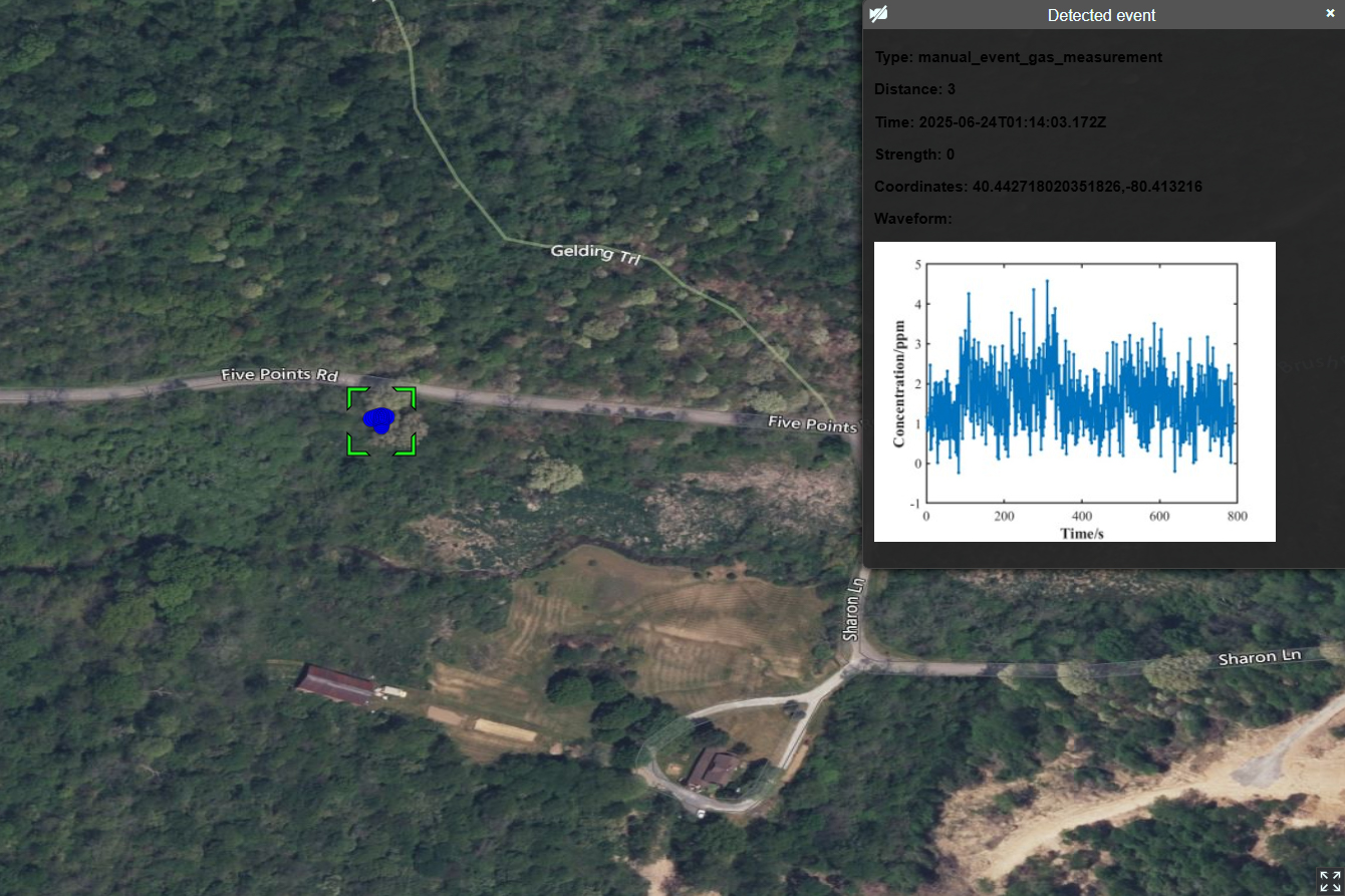
Real-Time Event Display on Geospatial Interface

Sensor data is processed, classified, and visualized in real time. The platform displays waveform data alongside geographic coordinates and event metadata, offering operators an intuitive view of field conditions for rapid response.

AI-Based Optical System Auto-Alignment

In this application, real-time sensor feedback is used to adjust an optical cavity lens assembly. The AI module interprets the sensing results and triggers alignment actions, illustrating AiMiLi’s capability to drive closed-loop control from data to actuation.